THE NATURAL ENVIRONMENT
Geography 101
ToC
MOUNTAINS
Crust
Folding
Earthquakes
Volcanoes
Hawai'i
Hawaiian Volcanoes
|
|
BOX 1 |
As noted in earlier sections, the Hawaiian Islands were created by volcanism from plumes of magma rising over a mantle hot spot (see Chapter 9 -> Hot Spots). Hot spots produce mafic magma that hardens at the surface into basalt; hence the vast majority of the Islands' rocky bulk is built of this material.
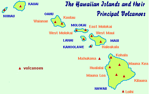
Hot spot volcanism created all of the Islands and each is composed of one or more volcanic shields as shown in the map.
Active Volcanoes
 Volcanoes
are considered active when they are either in
the process of erupting or showing signs of an impending eruption.
Three Hawaiian volcanoes fit this description. Mauna
Loa,
the world's largest mountain, last erupted in 1984, sending lava to within
seven kilometers (four miles) of Hilo town. Kilauea,
the world's most active volcano, has erupted continuously since 1983. Loihi,
an underwater volcano 110 kilometers (70 miles) south of the Big Island, has erupted
sporadically since 1996.
 The
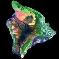
satellite image of the Big Island highlights the areas of recent lava
flows and bare lava fields in black and dark blue. The
latest eruptions of Kilauea have occurred east of the central Halemaumau crater. The easternmost flow draining into the ocean shown in the image originated several miles inland at the Pu'u O'o vent, a source that has since become inactive.
All of these active volcanoes appear to be connected directly to the underlying hot spot magma plume and evidence suggests that eruptions from one of the mountains may affect activity in the others. Mauna Loa, for example, has been fairly quiet since the onset of Kilauea's latest series of eruptions.
 The
active Big Island volcanoes are among the most studied on Earth. In 1912, the
Hawaii Volcano Observatory was established on the rim of Kiluaea caldera as one of the earliest science stations of its kind on Earth. Interest in understanding the inner workings of volcanoes at the time was high due to a catastrophic 1902 eruption that killed over 30,000 people on the island of Martinique in the Caribbean. In an interesting parallel to Hawaiian legend, the name of that volcano is Pelée.
 Much
has been learned over the past century. The two active mountains, for example, are split
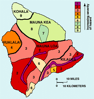
by rift zones, which are shown as purple stripes on
the hazard map. These huge cracks essentially separate the northern
and southern
flanks of the mountains and are frequent sites of eruptive activity.
The current eruption of Kilauea, for example, has taken place largely in the
East
rift zone with occasional activity in the central caldera.
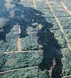 Because
Kilauea and Mauna Loa are active, lava flows often create a hazard,
posing a threat to human life and property. This has prompted the US
Geologic Survey to create a lava hazard map. The map objectively shows
the chances of land being covered with lava over various periods
of time. At highest risk are areas directly atop the rift zones and directly
downslope from them (1 and 2 on the map). Zone 3 areas are partially protected
by topography. This map is somewhat controversial, not in its scientific
basis, but because it has been used to set insurance rates on the Big
Island.
Dormant and Extinct Volcanoes
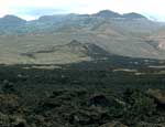 Volcanoes
that have erupted in historic time, but currently show no evidence that
new activity is imminent, are referred to as
dormant. (Note: some geologists would consider dormant
volcanoes to be active.) Two Hawaiian mountains fit this description.
Hualalai, on the Big Island last erupted in 1800 and
1801 sending two long flows of lava down its flanks that ultimately
reached the ocean. Haleakala, on Maui,
last erupted around 1790. The flow from this event entered the
ocean on the south shore of Maui in the La Perouse Bay area.
The other Hawaiian volcanoes are considered extinct, meaning that they have not erupted in historic times and are not expected to erupt anytime in the near future. This does not mean that they have been entirely quiet, however.
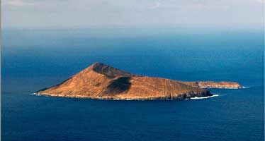
A rejuvenation phase of volcanism can still produce eruptions millions of years after the Islands have moved away from the hot spot. Blobs of magma, cut off from their mantle source, continue to slowly rise through the lithosphere by buoyancy. When they reach the surface they produce small eruptions and tuff cones. These small cones exist on most of the major Islands. On O'ahu, Diamond Head, Punchbowl, and Manana (Rabbit) Island are examples. These apparently formed within the past 100,000 years or so. Lehua Island (below) near Ni'ihau is another example of rejuvenated volcanism on the flanks of extinct volcanoes in Hawai'i. Eruptions like the one that formed Lehua are said to be phreatomagmatic, meaning infused with water, which can make them explosive when the water flashes to steam.
