Oceanographic, Atmospheric Data Sets for the Hilo-Hawai'i Region
Oceanographic, Atmospheric Data Sets for the Hilo-Hawai'i Region
Tides
NOAA Hilo Bay (Kuhio Bay) Tides
USC Tide Predictor- Kawaihae Harbor
Hawaii Regional Model Data
Navy HYCOM Model: Sea surface elevation, Salinity, Temperature, and Currents
UH Manoa ROMS Model: Sea surface elevation, Salinity, Temperature, and Currents
Satellite Data
Aqua/Modis Satellite Data- Pacific
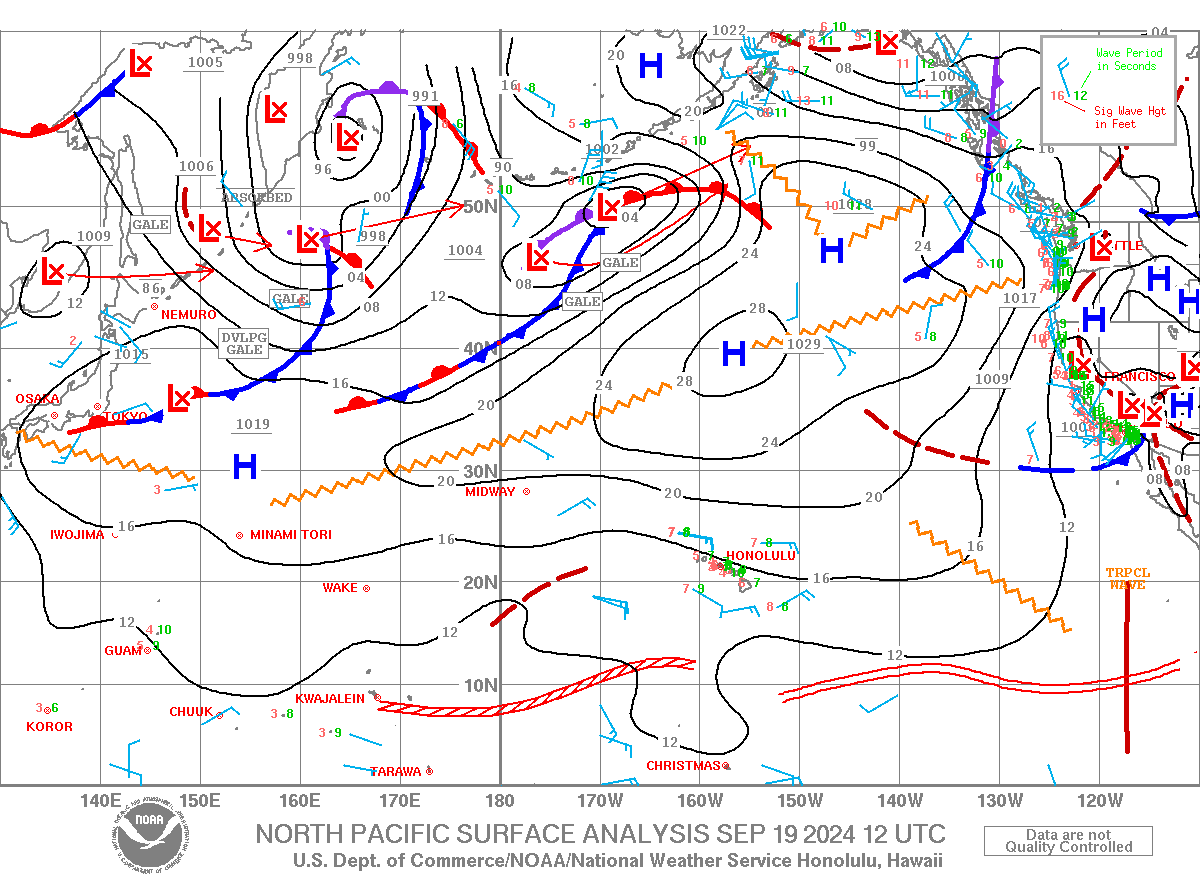
NOAA
Oceanwatch: Surface Elevation, Weekly or Monthly Chl a, weekly SST